Have It Both Ways: In Person and Online Events

In the post-COVID world of events, attendees get to have their cake and eat it too. A recent survey from Government Executive's Market Connections showed that in-person attendance is rising while online attendance is staying steady. In this latest study, over half of respondents said they had attended one to three in-person events over the past year. Three in 10 respondents have participated in four to six webinars per year. These numbers mirror what we found in surveying our members late last year.

With public health concerns largely gone, there are new decision points as to what makes an event worth attending. Continue reading

Geospatial Technologies Find Their Place in Planning

Geospatial data ties information to a location. Geographic Information Systems (GIS) layers this location data over any other data set, creating some important insight for public policy, infrastructure, and citizen service planning in a number of areas.

  • Sustainability - perhaps the most obvious use of geospatial data is in helping understand the current environment. With a view of air quality, tree cover, water levels, and more, communities can not only monitor ongoing changes but model what impact new construction or programs could have on an area. The Centers for Disease Control and Prevention created an interactive map to help state and local leaders understand the environmental burdens on their communities' health. Combining 36 health, social and environmental indicators, the application assigns an environmental justice score per census tract. This allows officials to see and then prioritize action for vulnerable areas. If a local government is looking to add a manufacturing plant, they can not only see what current pollution levels are, but can also determine if an area is made up of largely non-English speakers so that they know how best to communicate and involve the community in decisions about the plant.
  • Policing - The Justice Department is looking for proposals that apply geospatial data to track criminal activity affecting businesses and neighborhoods. Understanding where and when incidents occur and who may be involved helps police departments target patrols and implement programs that can help prevent incidents.
  • Public health - The Washington Department of Health's GeoHUB layers various department datasets over location information. Geospatial information helps pinpoint access to services across the state. Staff can analyze the state's transportation network and the location of, say, dialysis facilities to identify where residents do not have easy access. Presenting this information on a map makes it more digestible than having to parse out information from multiple charts and graphs.
  • Elections - State elections divisions use geospatial information and systems to enhance the efficiency and utility of election systems. A huge problem is ensuring addresses are correctly aligned to the right precincts so when people register to vote they are assigned the right polling place. Precinct lines are changed on the local level while registration frequently happens at the state level. Mapping addresses with precincts in real time allows for more accurate assignments.

Continue reading

The Highs and Lows of Strengthening the Federal Workforce

The federal government has put an emphasis on the need to strengthen the federal workforce. A strong federal workforce is one that is diverse in terms of race, gender, age, and experience. It is also made up of people with the skills needed to utilize and innovate with modern technologies. The results of diversity and hiring efforts have been mixed, providing insight into what really works in recruiting and retaining a strong federal workforce.

Help Wanted = Data Wanted

NASA has been working on improving the diversity of its workforce for over a decade. However, a recent report showed that despite all of the focus and effort, little progress has been made. The report found that demographics of NASA's workforce remain mostly unchanged since 2012 with only small increases of 1% to 2% for some demographic groups. NASA continues to lag behind the general federal workforce demographics with women making up 35% of the NASA workforce as compared to 45% of the general federal workforce. Women make up only 25% of NASA's scientific workforce compared to women holding 31% of scientific jobs elsewhere in government. Continue reading

Who, What, Where, and How of Improving Broadband

With so much of our activity and interaction being digital, the Internet is now a utility nearly as critical to daily functioning as heat or water. Inequitable access to broadband Internet access became quickly apparent during the pandemic lock down when kids lacked access to virtual school and adults were unable to complete work from their homes. Increasing broadband access is a key part of the bipartisan infrastructure law and is also supported by the Broadband Equity, Access, and Deployment (BEAD) Program. This funding is a huge step in rolling out broadband access nationwide, but there are many questions that need to be addressed to truly close the digital divide.

Where: Defining the Need

To effectively provide broadband, the government has to know where exactly it is needed. The Federal Communications Commission's broadband fabric map shows where fixed broadband access could be installed and has recently added more than one million new locations as well as removed over 1 million that were found to be mapped to structures such as garages and sheds. Being able to differentiate if an address is a residential or commercial building, a large property housing multiple families, or simply a storage shed is critical to ensuring that new broadband access is provided where it is actually needed. Agencies are working to combine this type of contextual data with the address mapping data to better plan broadband roll outs. Continue reading

Innovative Infrastructure

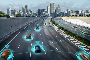
The Bipartisan Infrastructure Deal (also known by the formal title, Infrastructure Investment and Jobs Act), kick-started activity to modernize our nation's critical physical assets and reimagine how we use transportation, utilities, and more with $1.2 trillion in funding. In just the last year, $200 billion has been distributed over 20,000 projects in all 50 states and U.S. territories. That includes starting repairs to more than 69,000 miles of roadway, 500,000 electric vehicle charging stations, 3,700 bridge repair and replacement projects, and fielding of 5,000 clean transit school buses. Money continues to be made available through grants to improve legacy infrastructure and introduce new technologies to improve how the nation uses infrastructure.

Everything Old is New Again

Rail travel is receiving heavy investment due to increased usage and demand. Virginia and North Carolina have seen record-high ridership in the last year and those states are now looking for ways to increase the number and frequency of passenger travel. Virginia is looking to purchase right of way from freight railroads, so it can install passenger-only tracks at key chokepoints. Tennessee is also looking to increase rail options in the state pulling together potential ridership numbers to advocate for federal investment in new rail lines to serve the state and surrounding metropolitan areas. Continue reading